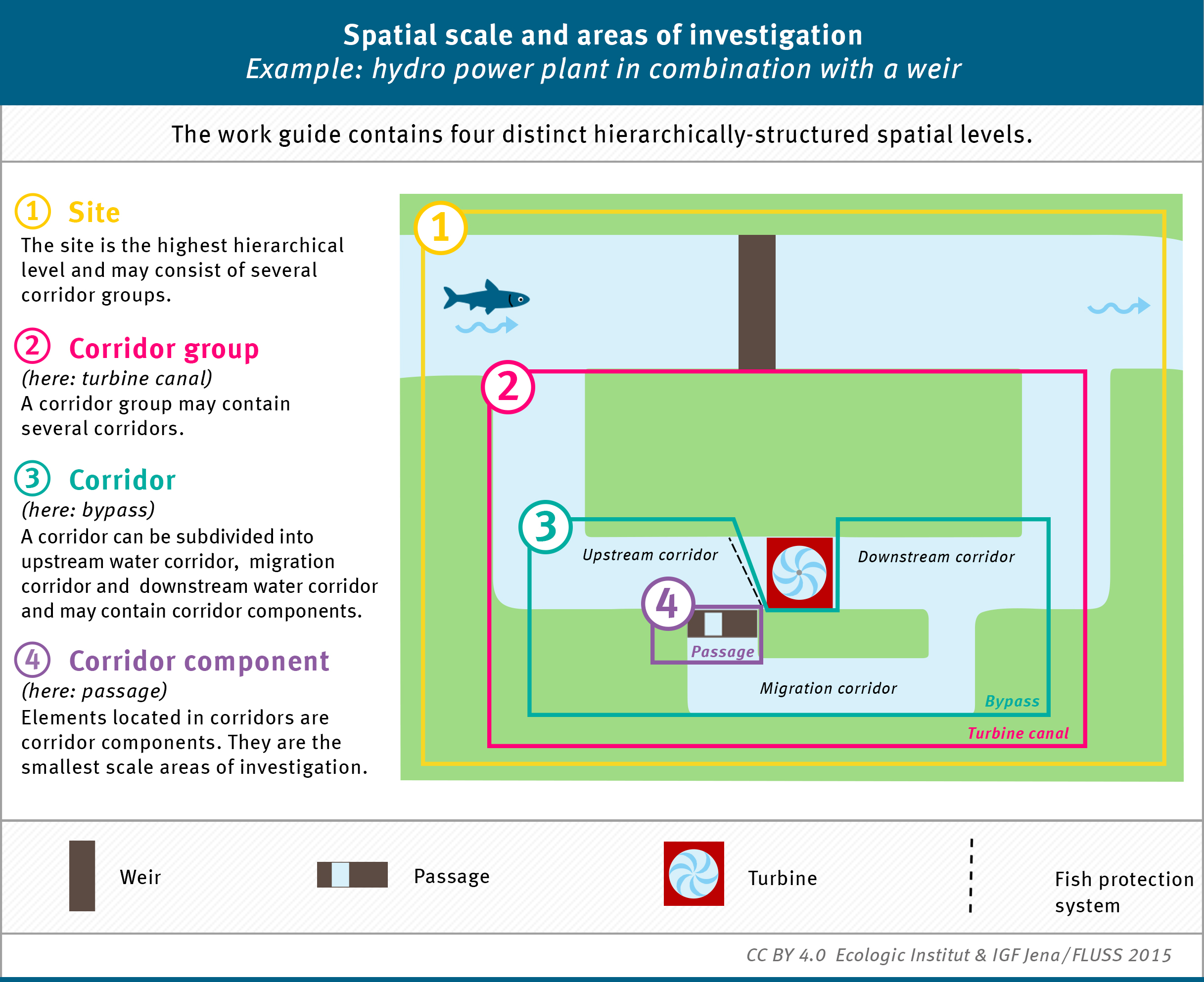


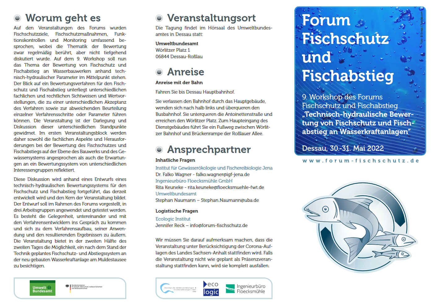
Spatial Scale and Areas of Investigatin – Example: Hydro Power Plant in Combination with a Weir
- Publication
- Citation
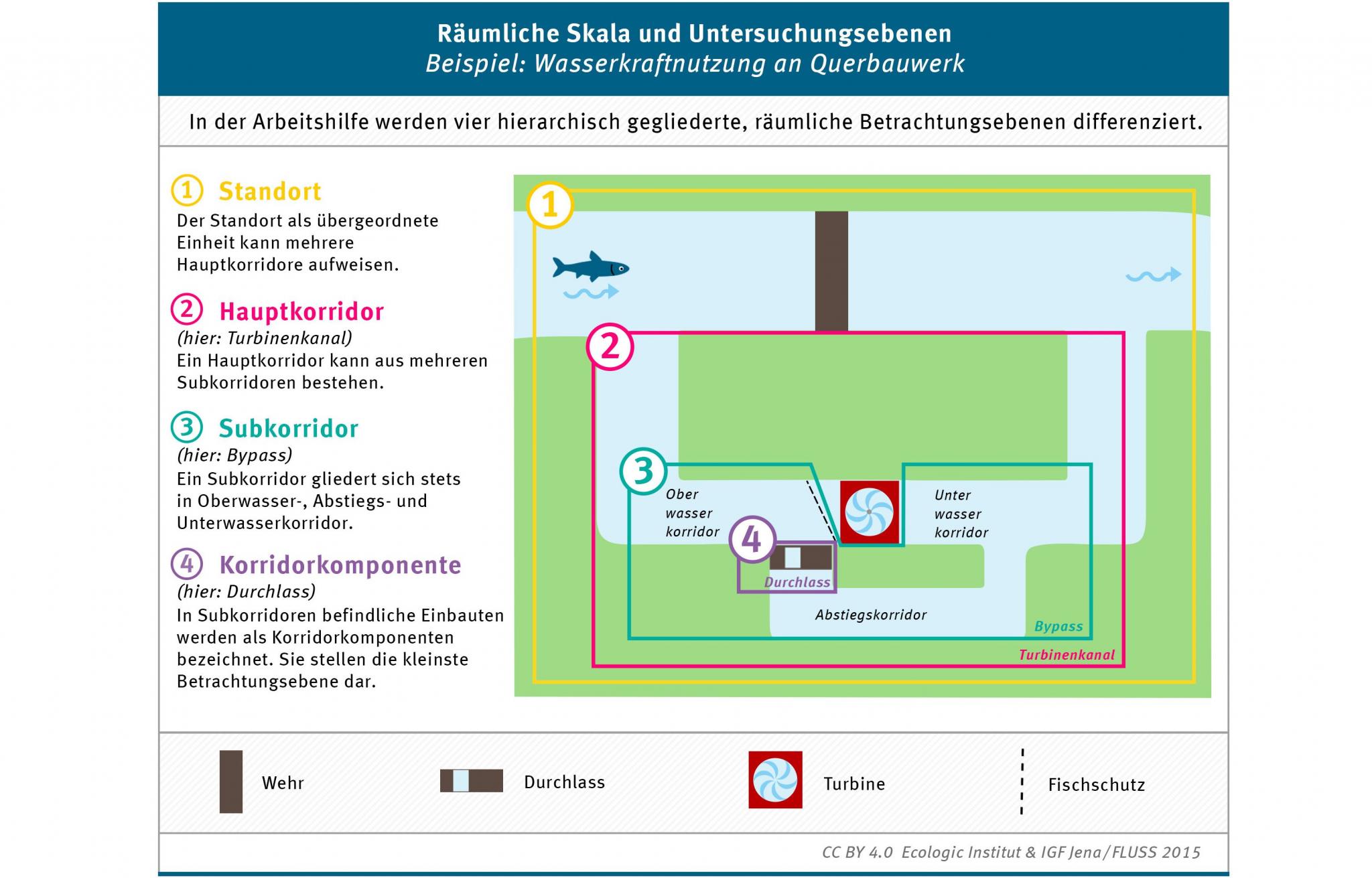
Ecologic Institut & IGF Jena / FLUSS (2015): "Räumliche Skala und Untersuchungsebenen - Beispiel: Wasserkraftnutzung an Querbauwerk". Infographic published in: Schmalz, Wolfgang; Falko Wagner und Damien Sonny 2015: "Arbeitshilfe zur standörtlichen Evaluierung des Fischschutzes und Fischabstiegs.", page 48.
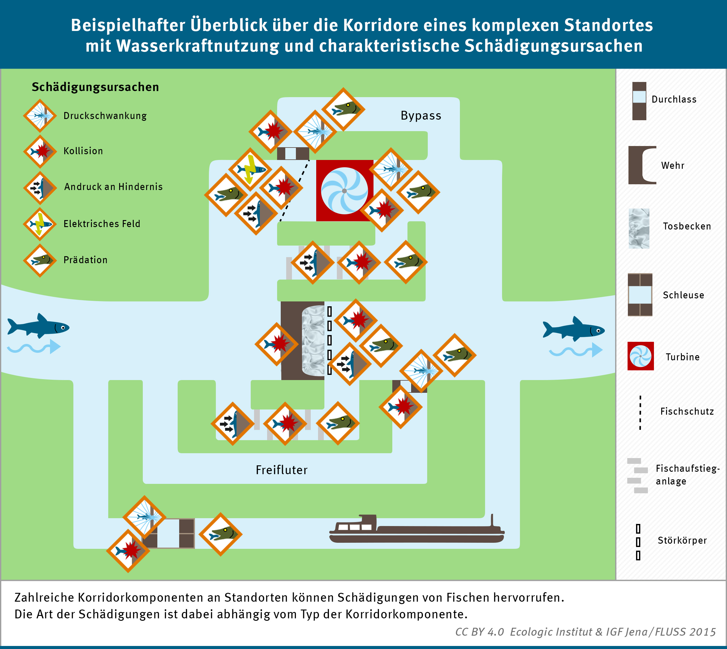
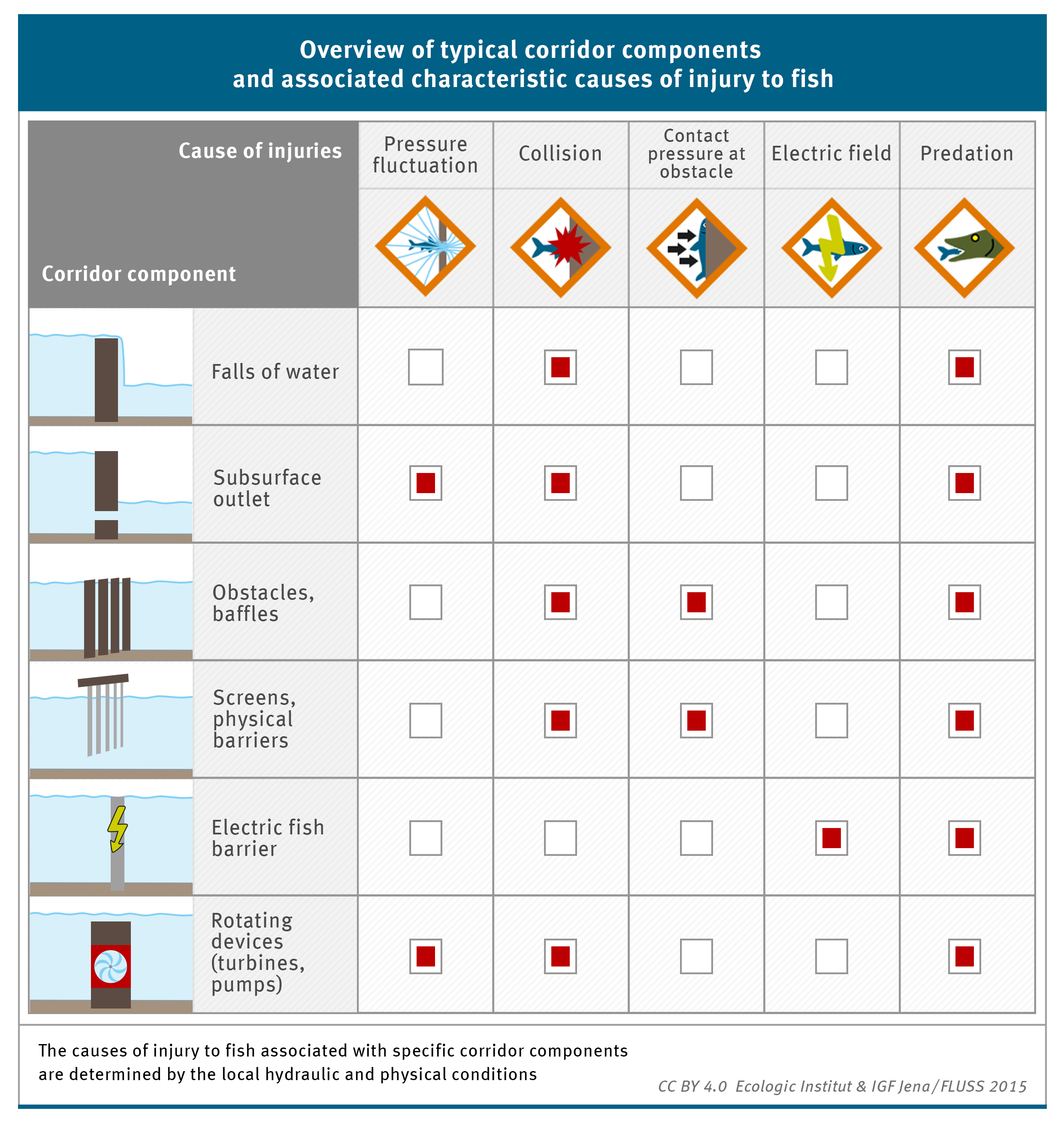
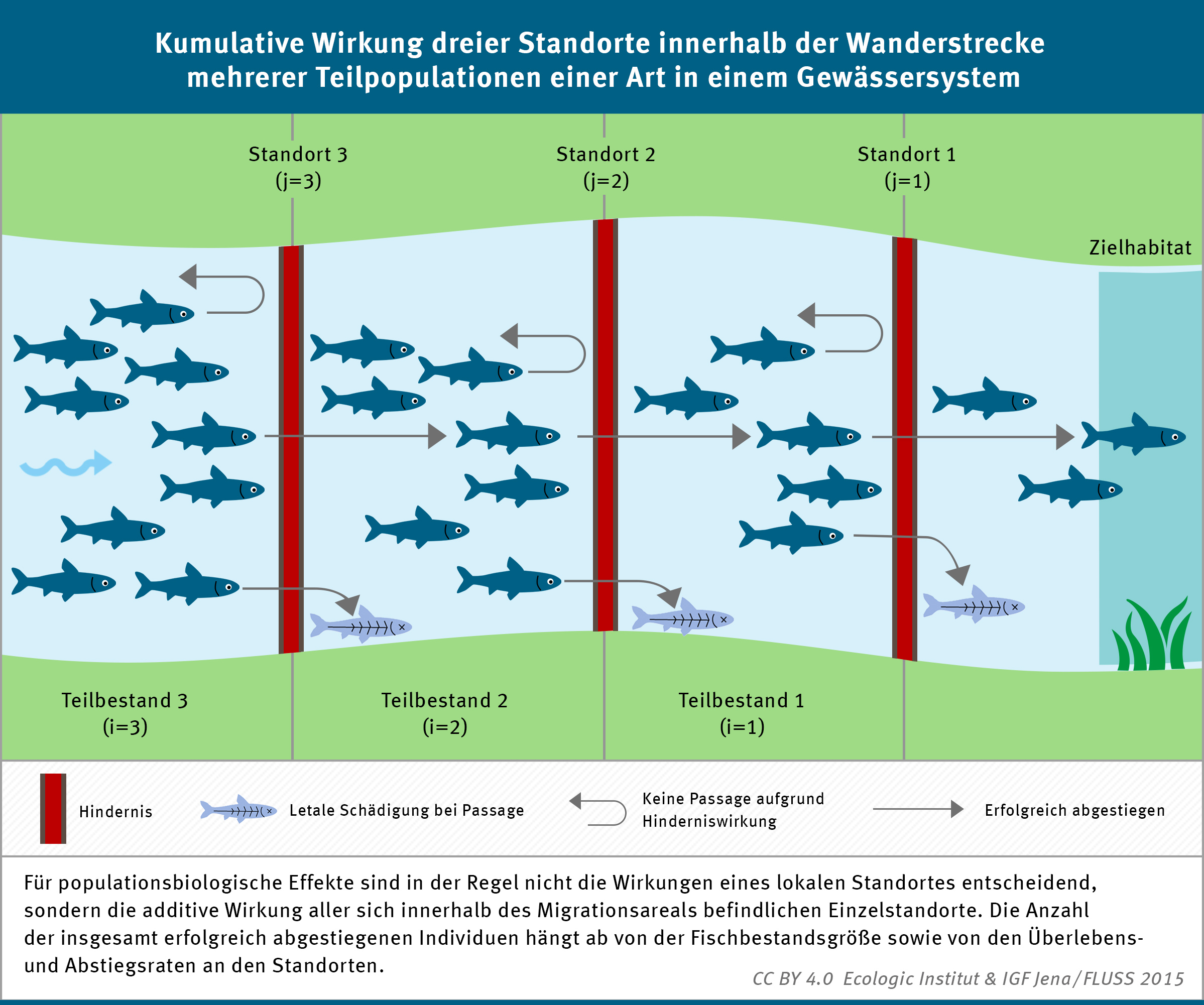
The infographic visualizes the four spatial areas of investigation of the manual in an examplary fashion. The spatial levels are: site, corridor group, corridor and corridor component.
The infographic is part of a manual that focuses on the site specific evaluation of the efficiency of fish protection and bypass systems. Standardized evaluation principles are defined to promote significant, comparable studies. The manual constitutes a framework for an objective evaluation process.
The infographic is published under a creative commons license CC BY 4.0. That means it can be copied and redistributed in any medium or format and for any purpose as long as appropriate credit to the authors is given.
Contact


- Languages
-
GermanEnglish
- Credits
Media format: coloured infographic for a printed manual
Copyright: CC BY 4.0
Concept: Falko Wagner (IGF - Institut für Gewässerökologie & Fischereibiologie), Melanie Kemper
Graphic design: Beáta Vargová- Funding
-
German Environment Agency (UBA), Germany - Published in
- Arbeitshilfe zur standörtlichen Evaluierung des Fischschutzes und Fischabstiegs
- Year
- Dimension
- 2398 x 2047 px
- Project
- Project ID
- Keywords
-
Fischschutz, Fischabstieg, Evaluation, Standort, Hauptkorridor, Subkorridor, Korridorkomponente, räumliche Skala, BetrachtungebeneDeutschlandInfografik, Visualisierung, Illustration, Creative Commons, Arbeitshilfe
First Cycle of the German Participatory Forum on Fish Protection and Downstream Migration
- Duration
-
-
- Funding
-
German Environment Agency (UBA), Germany
Schmalz, Wolfgang; Falko Wagner und Damien Sonny (2015): Arbeitshilfe zur standörtlichen Evaluierung des Fischschutzes und Fischabstiegs.